By Rodney McCulloch
100 ‘prisoners’ escape from Meriden in the centre of England, and see how far away they can get in 24 hours. No, it’s not a plot taken from a new primetime ITV drama as it’s not real prisoners… it’s the brainchild of Race Director Richard Weremiuk of Beyond Marathon Events.
The event’s website describes the race as follows:
“In Meriden, a 500 year old cross marks the centre of England. You have 24 hours to get as far away from Meriden as you can. You can only travel on foot. The Crow will be watching you.”
I first heard about it from Owen Delaney, as he participated in the first ever Escape From Meriden in Autumn 2016. I absolutely fell in love with the concept, this was no ordinary event: not an A to B route, no fixed finish line, no aid stations, no cut offs, you can decide how far you want to go, how fast you want to go, and more significantly — where you want to go.
I had no hesitation in entering the Summer edition one for 2017, it channeled the inner explorer in me, sounded like a completely unique event and it would be my first ultra race for 3 years. Running in my first ever London Marathon was supposed to be my main race for 2017, but Meriden was the one that had got me really excited, a proper all day adventure.
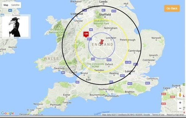
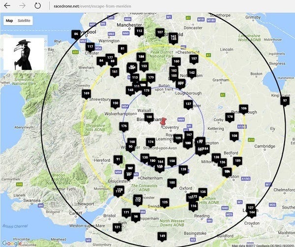
The aim in this event is to travel as direct as possible away from Meriden to ensure the furthest distance away as the crow flies, so route planning is very important. The map below shows the radius points 30/60/90 miles away from Meriden as the crow flies:
Race day Plans
Preparation for the event had not gone smoothly, as I had picked up a foot injury during the London Marathon just six weeks before race day — so I rested up to see if I could recover in time, and have an early taper you might say.
The rest meant I felt fresh coming into the event, but definitely lacking recent mileage, so I set a goal from the outset to try and reach 60 miles as the crow flies for the Gold Crow Medal award (30–60 miles gets a Silver Crow medal, and 90+ miles gets the coveted Black Crow Medal). Gold felt like a realistic target, but it would test my limits and probably require going further than I ever have before in a single day.
Sent to Coventry, to Escape From Meriden
I decided to follow the same route Owen had done previously, heading south east towards London, passing Towcester and Milton Keynes. I had everything packed for the 24 hour journey ahead: headtorch, phone with the route mapped out, bagels, butter flapjacks, jelly babies, salted crisps and plenty of drink. I just hoped the Crow would be smiling down on me on race day (and night), as I travelled north on the train to Coventry en route to Meriden for Friday night.
Registration
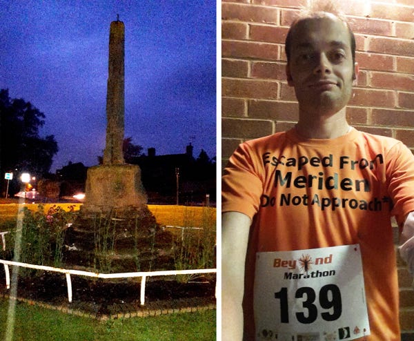
I arrived in the sleepy village of Meriden just after 10pm, and firstly I visited the Cross on the Village Green for good luck. The Cross — now a Grade II listed monument, has stood on the village green in Meriden for centuries, to commemorate the village’s claim to be the centre of England. The name Meriden derives from Saxon times, meaning pleasant valley. Once I had completed my pilgrimage to the cross, I jogged over to the Village Hall for Registration.
I collected my number, GPS Tracker and the t-shirt (an optional extra) — which would give due notice/warning to the passers-by during the day!
It was a very welcome sight to see familiar faces Rob and Rachel at registration; although the heavy rain outside was not so welcome — and race director Richard informed us in his briefing that it could be raining for the first few hours — we hoped he was wrong!
Into the Night
And so just before midnight, I made the short walk from the village hall to the village green along with 100 or so other prisoners, as the rain continued! Richard counted us down to zero and off we went as the clock struck midnight… that would be the last time we would all see each other, as everyone followed their routes north, south, east or west.
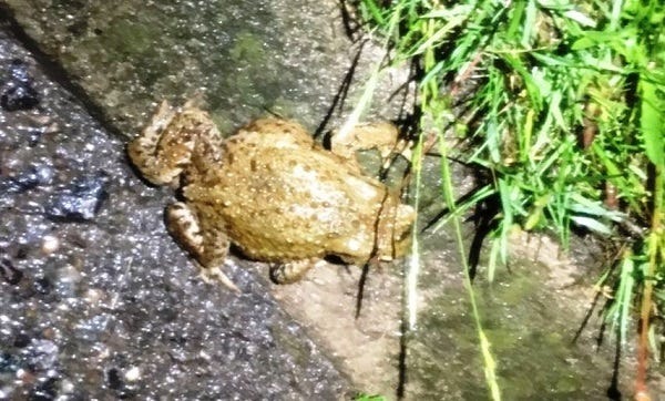
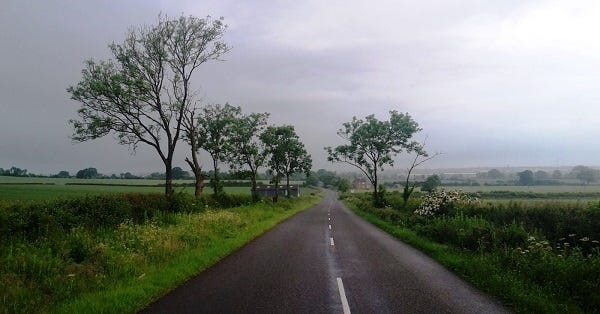
I headed south east with Rob and Rachel into the night, it was really good to have company for the first few hours of darkness through the country lanes and sleepy villages. Rachel’s head-torch was incredibly bright, like a car headlight, but it didn’t stop me going through numerous puddles as the rain was unrelenting and grim… even when the rain stopped we’d get a further dowsing from the trees. Our feet and socks and everything else were getting soaked right through. All we could do was keep moving, and take stock at dawn; at least the frogs seemed to enjoy the wet weather…
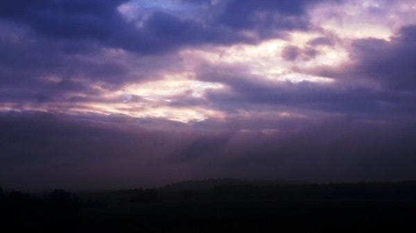
Daybreak
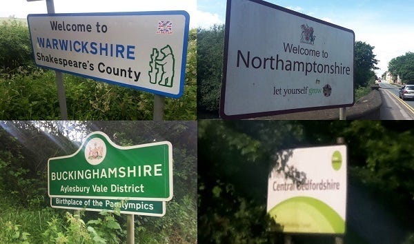
The birds were singing, I was yawning and daybreak had finally arrived. We stopped in Southam to take stock and change out of the wet jackets, and Rob changed socks — I didn’t bring a second pair, I just hoped the feet would dry out through the morning shift. As most people would be enjoying a Saturday morning lie in or preparing for parkrun, we continued on our way, out of Warwickshire and into Northamptonshire.
The overnight rain seemed to freshen up the air, and for the first time I was actually enjoying the race. I was taking in the rolling hills and endless countryside all around. The peace and tranquility of the early morning before the world woke up was magical, I had it all to myself. I was seeing parts of the country I wouldn’t have otherwise — a good to be alive moment and exactly why I was doing this race.
Morning sun
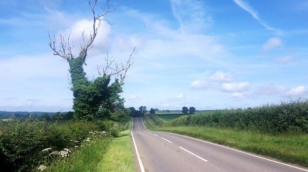
The early morning mist and cloud gave way to increasingly blue skies as it started warming up. Between and 6 and 10am was fantastic, I didn’t see another person for several hours, just passing the odd village or farmhouse. At times it didn’t really feel like I was in a race, I was just out for a sunny stroll in the country.
With every hour I felt stronger and I was able to run more as my feet dried out, racking up the miles and chasing down the first target — to get through 30 miles as the crow flies. Sadly for Rachel and Rob they weren’t enjoying their morning as much as I was, and they had to pull out having slowed down with blister troubles. I had taped up a couple of areas causing friction under my foot, but the feet seemed to survive the overnight soaking.
Brunch in Towcester
With roughly 40 miles under my belt, and around 34 as the crow flies, I arrived in Towcester just before 11am. It was the first major town of the day, and yes it really is pronounced like ‘Toaster’, but there was no time to stop for a toasted bagel. Towcester is described by Wikipedia as an affluent market town in Northamptonshire, The area was settled in Roman times, when it was known as Lactodorum. The modern town name comes from the Old English, meaning ‘Camp on the river Tove’.
I set up camp briefly in Towcester to refuel for brunch by Towcester Racecourse, which first opened in 1928 and was the location for Tony McCoy’s 4000th winning ride as a jockey in 2013.
Refuelled and energised, it was time to leave Towcester and march on towards the next major target of the day — Milton Keynes, which was 12 miles away.
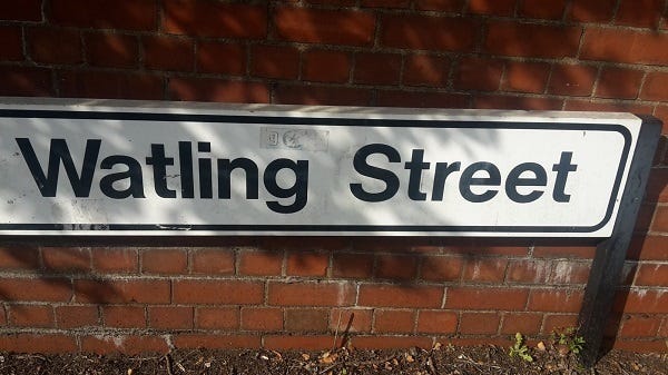
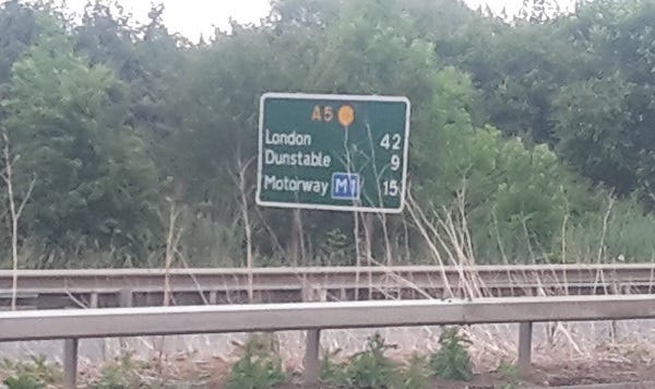
At this point I joined the A5, which mostly follows the original Roman Road of Watling Street — a road which once spanned most of southern England between Dover and Wroxeter (Read about the full route here). I would be keeping close company with Watling Street for the next few hours, so I hoped it would look after me and keep me out of the Crow’s clutches.
Watling Street
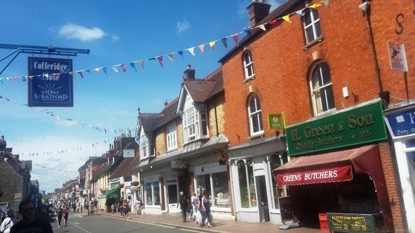
As I had got used the monotony of Watling Street, I felt in a good rhythm and was able to run quite strongly at times, which I wasn’t expecting after more than 12 hours on my feet! The section between Towcester and Milton Keynes seemed to pass quite quickly, as I arrived in the town of Stony Stratford — a typical English market town in middle England, with some Morris dancers in the high street. It was warming up, so it was time to get more liquid on board and refuel as I reached Buckinghamshire — my third county of the day.
The Battle of Milton Keynes
As I reached the outskirts of Milton Keynes around 2pm, I was told by Owen to be aware of the perils of this new town. I looked at the map and it seemed to be 8.4 miles from west to east across this urban concrete jungle, and with tired legs and mind it was going to be a long drag — just keep it simple, and keep moving.
I’d already ticked over 50 miles on foot, and was roughly halfway between the 30 mile (Silver) and 60 mile (Gold) radius points away from Meriden, but this is when the demons started to creep in. I had tried to sleep during Friday pre-race with little joy, and the lack of sleep was now starting to tell, the legs began cramping up, the lack of training was finally catching up with me. The torture of Milton Keynes had only just begun…
Escape from Milton Keynes
For the next few hours, Escape from Meriden became Escape from Milton Keynes.
One of the factors in MK that I found really difficult to deal with were all the roundabouts… one after another that was absolutely identical — which makes sense from a town planning point of view, but it was messing with my head.
The problem with seeing identical roundabouts every 15 minutes was the paranoia of thinking “have I been here before?”, as I kept checking my GPS to confirm I hadn’t done a U-turn! I had to stop several times with cramping legs — but I knew if I stopped for too long I would not get going again.
Milton Keynes was designated as a new town on 23rd January 1967, so they celebrated their 50th anniversary this year — but the only thing I celebrated was seeing the back of it, and all its roundabouts! (Apologies to the people of Milton Keynes).
Canal or Road?
The online support helped keep me moving through MK, and by 5:30pm I had covered nearly 60 miles on foot. I was alone out on the road, but I didn’t feel alone. It was time to stop again and refuel in Bletchley, and having survived MK, I felt a bit stronger again and ready to go for the evening ahead.
To reach the 60 miles as the crow flies away from Meriden for the Gold crow medal, I still had some work to do. Plan A was to head south towards Tring on the Grand Union Canal towpath — but Tring was still 18 miles away — and I would barely finish by midnight, with 2 hours of darkness. Plan B was to stay on the arrow straight Watling Street on the A5 for the 12 miles to Dunstable, with a chance of finishing by dusk. Common sense prevailed, and I went with plan B and set off for Dunstable.
The Final Countdown
Even on tiring legs and mind, I felt I could grind out the miles through the evening and ticked off the miles one by one as I closed in on Dunstable. I knew I was getting closer to the dream goal of the day to reach the 60 mile radius and the realisation that I was going to make it was absolutely wonderful. At the start of the day I had that goal but I never thought too far ahead, I tried to stay in the moment. It was a lovely evening, starting to cool down but still some soft sunshine to enjoy the views of the Chilterns as I reached Bedfordshire.
WhatsApp Messages kept my mind occupied off of the aching body, which really helped in those last few hours — when even the tiniest road undulations felt like mountains to my legs!
I was treated to a glorious sunset as I passed Hockliffe, the final village before Dunstable.
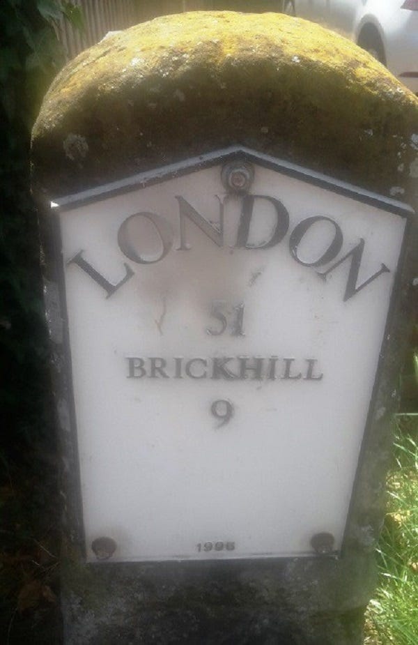
As I reached the final mile into Dunstable I got my phone out and was watching my dot on the map move closer to my goal, creeping closer as the tracker refreshed on the website every 2 minutes. At 21:30, after over 21 hours of running, walking, crawling, I finally made it through the 60 mile radius point!! It seemed to happen right by the ‘Welcome to Dunstable’ sign, so it was a fitting moment to stop and take in the moment and look back on the day and all the sights and sounds I had passed, and the highs and lows. I was absolutely elated that I had reached my goal, and had so many memories to take away from the day.
My final stopping place of Dunstable has been a market town since 1109 (as the sign above says!), but its origins go back much further than that. In Roman times the settlement was called Durocobrivae or Durocobrivis, located on the junction of Watling Street and Icknield Way. Icknield Way is an ancient trackway which predates the Romans and crosses southern England between Norfolk (Bury St Edmunds) and Wiltshire (Salisbury). Today it can be closely followed across the Chilterns by walking The Ridgeway — a National Trail.
I began walking again, towards the centre of Dunstable, looking for a takeaway, when Ravi (who kindly offered me a lift back — legend!) spotted me on the High Street at 9:35pm.
There was a quick stop for a photo, but before getting in Ravi’s car it was time to turn the tracker off! The crow had caught me at 21:36, in exchange for a gold crow medal.
My total distance away from Meriden as the crow flies was 97.3km (60.46 miles). My watch died mid-afternoon, but I think the total distance covered was 111km (69 miles) — my furthest distance in a single day.
A tiny part of me thought about carrying on until midnight towards St Albans, but I was more than happy with what I had achieved.
As I tucked into a Big Mac and fries, I checked out how everyone else was getting on, remarkably a couple of people had made it into central London — the first time it had happened on this event, and they earned black crow medal for 90 miles away from Meriden as the crow flies. Just 4 black crow medals were given out this time. Well done to everyone who took part — I think it’s an event that’s captured the imagination of many people; it’s amazing to see how spread out everyone was in 24 hours in every direction!
The best ideas are usually the simplest ones, and Richard has come up with a gem here — from such a simple concept the possibilities are endless! It was one of the hardest things I’ve ever done, but one of the most rewarding and a day I’ll never forget.
Thanks Richard for putting on such a superb event, thanks to my body for holding up, thanks to Rachel and Rob for their company for the first few hours, thanks to Milton Keynes for nearly breaking me, thanks to the Romans for building Watling Street and thanks to everyone for supporting and following me through the day. Already thinking about what I will do next…


